Everybody knows this is nowhere
Three days, two camps, 36 miles of tramping between two Highland villages, and just enough weather to make us uncomfortable if not quite threatened. There was a bit more to it than that though.
The walk started through parkland around Blair Castle. Mick met me from the train at Blair Atholl station. Fife had been bathed in sun but here amongst the hills the clouds were heavy and rain threatened. We walked up through Glen Tilt, losing layers as we went. In conversation we missed signs for a diversion from the path around a washed-out section of track. We weren't the first judging by the irate reaction of the contractors as we rounded the corner towards them. They let us past - just!
Glen Tilt has a long history of habitation. We crossed the river to the west bank, continuing on into the wilder middle reaches of the glen. We passed the barest remnants of old crofts, just piles of grey rock now, and remains of drystone walls climbed the hillsides. Mick sensed an atmosphere, and I did too, a lived-in feeling I've noticed in many similar places in the Highlands, a sense that the land remembers the people and expects them back.
The clearances here were comprehensive, the community forced out for sheep and 'sport'. Later, a famous, long-running access battle took place in 1847 when the 6th Duke of Atholl tried to evict a party of botanists and in effect block access to Glen Tilt, a long-established right of way. He lost the court case in the end.
We brewed up by an ancient stone bridge, still solid, that spanned a side-stream raging through a little gorge. Hamish Brown writes about this place in 'Climbing the Corbetts':
We carry on up the side stream towards the great moorland wedge of Beinn Mheadhonach flanked by the deep glens of the Diridh and Mhairc rivers which merge to flow into the Tilt. More ruined crofts, tumbledown walls, and another lonely stranded stone bridge...
It's an intermittently steep toil up the long south ridge, but the sun makes a rare appearance.
I've chosen this hill rather than neighbouring, higher Beinn Dearg as a route north, to avoid energy-sapping wet snowfields.
We're hit by a vicious squally snowstorm as we near the summit. Off the crest, fumbling with waterproofs, then a plod to the top as it blows over.
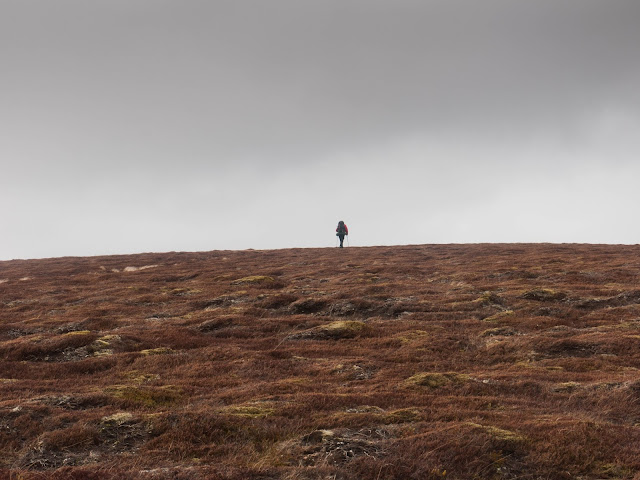
And we're over a kind of threshold as well, as we drop down the broad north ridge which merges gradually into rolling moorland. Ahead is the empty country around the headwaters of the Tarf and Feshie rivers. No tracks, no houses, for many miles; in a small way it's like walking off the edge of a map. Somewhere many miles ahead the tracks and blocks of conifers and muirburn patches and deer fences will reappear - but for now we're in country that has somehow escaped us.
It's tipping towards twilight as we pause at Loch Mhairc.
Less than a mile further on we hit the Tarf Water. As hoped there are many dry, grassy swards along the banks to pitch our tents on. The skies darken, the watchful, snow-streaked humps of the hills fold in on themselves. We're both tired. Mick measures out the Highland Park and we take a wander by the river, looking for somewhere to cross in the morning. The burns and rivers are on the high side, still fed by meltwater, and stained with peat tannins.
Back at the tent it's a pleasure to brew up and lie still with the door open and the stove hissing away. It's going to be a frosty one although all day the moors have been full of spring sounds, especially the meadow pipits.
Morning brings weak sun and a skin of ice on boots and still water. Ice rattles in the water bladder as I work numb fingers into action over a brew. We find a place to cross dry-shod and work our way up and round to Beinn Bhreac. Sopping bogs and clawing heather give way to dry turf, gravel and lichen. That early sun has given up the ghost and we're braced for more snow showers - and get them
The horizons are smeared with showers but thankfully we just keep the visibility as we follow the spine of the hills towards Leathad an Taobhain. It would be tough to navigate this landscape in low cloud. The gradients are so shallow and contours so spaced out it's hard enough telling one undulation from another - there is the exposure of rock and ridge, and there is this. I wonder if the Arctic Eye can be felt here? Arctic travellers have often described a sense of being watched, a psychological reaction to a landscape devoid of anything recognisably human, experienced sometimes as a desire to climb head-first into a sleeping bag.
But we make it over the empty miles, a rugged mix of bog, peat hags and wet snow underfoot.
On the summit of Leathad an Taobhain, Mick's altimeter gives a curious reading of 940 metres - some way above the 912 metres on the map. Now it feels like that wilderness middle section of the walk is over. We pick up a path, and pass a ruined Victorian deer stalker's bothy, then onto an estate track.
The cloud's been building all afternoon. We're tired again, it's almost an oppressive feeling - nothing good is coming out of the sky any time soon. On the track, concentration wanes and my eyelids start to droop. We find a fairly sheltered spot on grass by a small burn. We get the tents up. And then it rains for 12 hours solid. I don't sleep well. After a few hours the wind is sticking the tent outer to the inner and water is getting in. I long for my tarp. The ground proves to be uneven and I can't relax. I'm plagued by sleep paralysis dreams. I float about the tent, and find a television playing in the porch. That can't be right... I heave and gasp into consciousness.
Next morning, Mick doesn't seem to have fared much better. "It was a bit of a disaster" he sums up.
We're relieved to get away early though it's till sleeting. How to get to Kingussie? The Glen Tromie route involves an easy well-kept track, but a lengthy dog-leg west before heading north. The map shows a direct route north - a climb up to a saddle then down Gleann Chomraidh, on a path. Except the path only exists on the map, so we have many miles of bog and heather slogging, following the river from its infancy, teetering at first on deer tracks laced with worn and slippery heather stems, before we cross over to lower Glen Tromie and see Strathspey and Kingussie, our destination, laid out below. Gleann Chomraidh has not always been empty though; halfway down there's a network of old shielings from transhumance times, just circular piles of rocks now; but the land they're on is still good, a rare dry and grassy oasis that would make for fine camping, and is clearly a good home for a colony of moles.
We're drenched by a lengthy shower on the final miles of road walking but the early start pays off and soon we're downing pints and eating fish and chips before the train south arrives. Phones ping and texts are sent. It's 21st century Scotland, but it still feels like we dropped off the edge and clambered out again.
The walk started through parkland around Blair Castle. Mick met me from the train at Blair Atholl station. Fife had been bathed in sun but here amongst the hills the clouds were heavy and rain threatened. We walked up through Glen Tilt, losing layers as we went. In conversation we missed signs for a diversion from the path around a washed-out section of track. We weren't the first judging by the irate reaction of the contractors as we rounded the corner towards them. They let us past - just!
Glen Tilt has a long history of habitation. We crossed the river to the west bank, continuing on into the wilder middle reaches of the glen. We passed the barest remnants of old crofts, just piles of grey rock now, and remains of drystone walls climbed the hillsides. Mick sensed an atmosphere, and I did too, a lived-in feeling I've noticed in many similar places in the Highlands, a sense that the land remembers the people and expects them back.
The clearances here were comprehensive, the community forced out for sheep and 'sport'. Later, a famous, long-running access battle took place in 1847 when the 6th Duke of Atholl tried to evict a party of botanists and in effect block access to Glen Tilt, a long-established right of way. He lost the court case in the end.
We brewed up by an ancient stone bridge, still solid, that spanned a side-stream raging through a little gorge. Hamish Brown writes about this place in 'Climbing the Corbetts':
I find it a sad spot: the vivid green, the villages of tumbled stones, the shivering birch trees - and a sturdy bridge that has not seen wheels for a century.The muffled roar of water, spots of rain, and the hiss of the stove - all blend with the atmosphere of this place. It's good to be back out again, it's been far too long.
We carry on up the side stream towards the great moorland wedge of Beinn Mheadhonach flanked by the deep glens of the Diridh and Mhairc rivers which merge to flow into the Tilt. More ruined crofts, tumbledown walls, and another lonely stranded stone bridge...
It's an intermittently steep toil up the long south ridge, but the sun makes a rare appearance.
I've chosen this hill rather than neighbouring, higher Beinn Dearg as a route north, to avoid energy-sapping wet snowfields.
We're hit by a vicious squally snowstorm as we near the summit. Off the crest, fumbling with waterproofs, then a plod to the top as it blows over.
And we're over a kind of threshold as well, as we drop down the broad north ridge which merges gradually into rolling moorland. Ahead is the empty country around the headwaters of the Tarf and Feshie rivers. No tracks, no houses, for many miles; in a small way it's like walking off the edge of a map. Somewhere many miles ahead the tracks and blocks of conifers and muirburn patches and deer fences will reappear - but for now we're in country that has somehow escaped us.
It's tipping towards twilight as we pause at Loch Mhairc.
Less than a mile further on we hit the Tarf Water. As hoped there are many dry, grassy swards along the banks to pitch our tents on. The skies darken, the watchful, snow-streaked humps of the hills fold in on themselves. We're both tired. Mick measures out the Highland Park and we take a wander by the river, looking for somewhere to cross in the morning. The burns and rivers are on the high side, still fed by meltwater, and stained with peat tannins.
Back at the tent it's a pleasure to brew up and lie still with the door open and the stove hissing away. It's going to be a frosty one although all day the moors have been full of spring sounds, especially the meadow pipits.
Morning brings weak sun and a skin of ice on boots and still water. Ice rattles in the water bladder as I work numb fingers into action over a brew. We find a place to cross dry-shod and work our way up and round to Beinn Bhreac. Sopping bogs and clawing heather give way to dry turf, gravel and lichen. That early sun has given up the ghost and we're braced for more snow showers - and get them
The horizons are smeared with showers but thankfully we just keep the visibility as we follow the spine of the hills towards Leathad an Taobhain. It would be tough to navigate this landscape in low cloud. The gradients are so shallow and contours so spaced out it's hard enough telling one undulation from another - there is the exposure of rock and ridge, and there is this. I wonder if the Arctic Eye can be felt here? Arctic travellers have often described a sense of being watched, a psychological reaction to a landscape devoid of anything recognisably human, experienced sometimes as a desire to climb head-first into a sleeping bag.
But we make it over the empty miles, a rugged mix of bog, peat hags and wet snow underfoot.
On the summit of Leathad an Taobhain, Mick's altimeter gives a curious reading of 940 metres - some way above the 912 metres on the map. Now it feels like that wilderness middle section of the walk is over. We pick up a path, and pass a ruined Victorian deer stalker's bothy, then onto an estate track.
The cloud's been building all afternoon. We're tired again, it's almost an oppressive feeling - nothing good is coming out of the sky any time soon. On the track, concentration wanes and my eyelids start to droop. We find a fairly sheltered spot on grass by a small burn. We get the tents up. And then it rains for 12 hours solid. I don't sleep well. After a few hours the wind is sticking the tent outer to the inner and water is getting in. I long for my tarp. The ground proves to be uneven and I can't relax. I'm plagued by sleep paralysis dreams. I float about the tent, and find a television playing in the porch. That can't be right... I heave and gasp into consciousness.
Next morning, Mick doesn't seem to have fared much better. "It was a bit of a disaster" he sums up.
We're relieved to get away early though it's till sleeting. How to get to Kingussie? The Glen Tromie route involves an easy well-kept track, but a lengthy dog-leg west before heading north. The map shows a direct route north - a climb up to a saddle then down Gleann Chomraidh, on a path. Except the path only exists on the map, so we have many miles of bog and heather slogging, following the river from its infancy, teetering at first on deer tracks laced with worn and slippery heather stems, before we cross over to lower Glen Tromie and see Strathspey and Kingussie, our destination, laid out below. Gleann Chomraidh has not always been empty though; halfway down there's a network of old shielings from transhumance times, just circular piles of rocks now; but the land they're on is still good, a rare dry and grassy oasis that would make for fine camping, and is clearly a good home for a colony of moles.
We're drenched by a lengthy shower on the final miles of road walking but the early start pays off and soon we're downing pints and eating fish and chips before the train south arrives. Phones ping and texts are sent. It's 21st century Scotland, but it still feels like we dropped off the edge and clambered out again.


Fantastic!
ReplyDeleteI love this patch of Scotland - I will be there again a month's time.
Great words, fabulous pictures. I was right there, with you.
:-)
Cheers Alan, it's a bit special isn't it. I've wanted to 'through hike' it for a long time and wasn't disappointed. Good luck with the trip next month - presumably the Challenge?
DeleteYes Sir.
Delete:-)
Thank you.